10 Best hikes in Mallorca
From Hidden Gems to some All-Time Favorite Trails
Have you been wondering about the best hikes in Mallorca? I’ve got you covered!
Every year I spend a few weeks in Mallorca. As the island has some fantastic hiking trails to explore, I am discovering new and great treks every time.
The Tramuntana Mountains, which stretch along the west coast of the island, and the stunning coastline provide a hiker’s paradise.
From the wild beauty of the mountain trails to the tranquil walks along the sea, Mallorca has it all. Especially in winter, the island offers some peace and quiet, away from the usual summer crowd.
Read on, to find my best hikes in Mallorca, a fantastic mixture of easy coastal strolls and challenging mountain trails.
Map of the best hikes in Mallorca
1. Sant Elm – La Trapa roundtrip
The beautiful hike ascends the cliffs beyond Sant Elm village and offers breathtaking vistas on the nearby dragon island. This is one of my favorite hikes in Mallorca!
Initially, the route meanders through a forest of pines and ancient olive groves. Before long, it begins its steady ascent, rewarding you with unparalleled views of the nearby islet.
Though the journey along this remarkable coastal path can be a bit challenging, but the panoramic scenery more than compensates for the effort!
A perfect spot for a pause, especially with views overlooking Isla Dragonera, is the historic monastery of La Trapa.
On the way back, you will first cross the Coll de ses Animes, with views of the coastal mountains and Sant Elm. Then the route returns to the starting point along wide, winding forest paths with great views and the last stretch through the forest.
Sant Elm – La Trapa roundtrip hike
Hiking time: 3h | Length: 9,6km / 5,9mi | Altitude meters: ↑ 400 & ↓ 400 |
Difficulty level: intermediate
⇨ GPS and more pictures tracked with Komoot


Rother Walking Guide Mallorca
This is the fantastic resource where I find most of my hikes or hiking ideas.
✅70 coastal and mountain walks
✅Every route with GPS data to download
✅264 pages in pocketsize; ideal for backpacks
2. Alcudia – Talaia d’Alcudia
At 446m, Talaia d’Alcudia is the highest point on the Alcudia peninsula. A wonderful hike connects the picturesque old town of Alcudia with the summit, with even several opportunities to swim in hidden coves.
Walk along the northern bays of Alcudia to the Emirata de la Victoria. Several swim-stops are possible in the different beaches that you will pass (i.e. Platja de Sa Font de Sant Joan or Platja de San Pere). If you prefer to shorten the hike, you can also drive up to the hermitage by car.
The route continues up wide forest roads. The final climb to the top is just a narrow path. The view of Alcudia bay and the entire north coast of Mallorca is simply breathtaking!
The descent continuous on small paths with great views. If you wish, you can make a detour to the picturesque bay of Platja des Coll Baix for another swim before returning to Alcudia.
Alcudia – Talaia d’Alcudia hike
Hiking time: 5h | Length: 20km / 12,4mi | Altitude meters: ↑ 580 & ↓ 580 |
Difficulty level: intermediate – difficult due to the length
⇨ GPS and more pictures tracked with Komoot

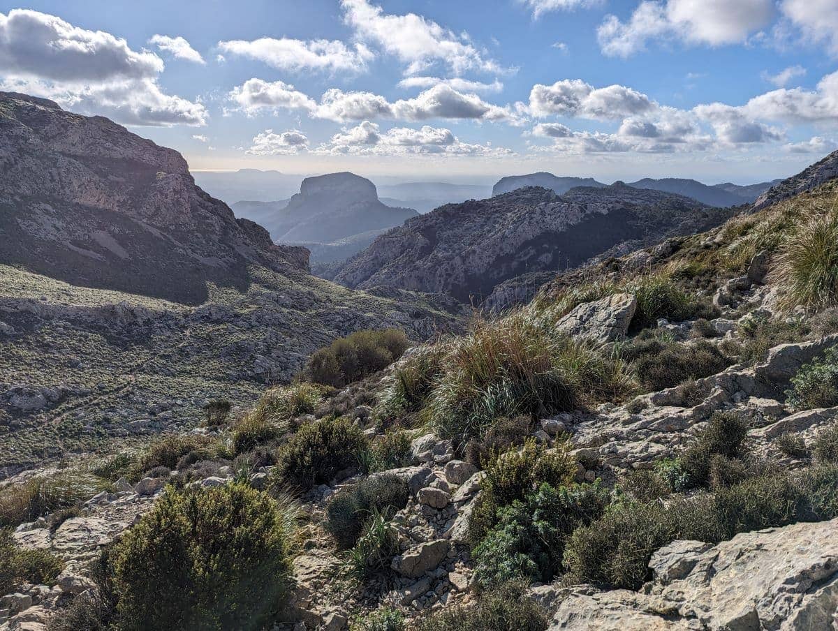
3. Tossals Verds
The diverse circuit around the Tossals Verds massif has everything that makes for an exciting mountain hike: steep mule tracks, magnificent panoramic views, quiet mountain lakes and rugged peaks.
The trail starts at the Cuber reservoir, which, like the Gorg Blau, can be seen from above after the first ascent. The path descends again along the Torrent d’Almadra gorge.
Along that passage, there is a short, more difficult section, secured with ropes. The Refugi de Tossals Verds is the perfect place for a lunch break.
If you have any energy left, you can climb to the top of Puig de Tossals Verds on the way back, which I did not do. The last part of the trail is easy, flat and offers once again great views along a water channel.
A fantastic roundtrip hike in the middle of the Tramuntana mountains in Mallorca.
Tossals Verds roundtrip hike
Hiking time: 5h | Length: 11,8km / 7,3mi | Altitude meters: ↑ 480 & ↓ 480 |
Difficulty level: intermediate
⇨ GPS and more pictures tracked with Komoot
4. Cala s’Alunia – Caló des Mármols Coastal hike
This easy coastal hike combines beautiful coastal landscapes and quiet bathing bays in Mallorca’s southeast.
While there may be other tourists at the starting point at the idyllic Cala s’Almunia, they should be left behind at the beginning of the narrow path through the maquis.
After crossing a small valley covered in maquis and pine bushes, you reach the coastal plateau and the steep cliffs.
From here you will always stay close to the impressive coast and hike along the edge of the cliffs. There is lots of space, no need to be afraid of it.
On the Punta des Bauc there are the remains of a Bronze Age watchtower. At some point you will arrive at Cala Figuereta, walk around it and then reach the small sandy beach of the turquoise Calo des Marmols.
I actually did that hike in the Mallorca winter, but if you hike in summer, do not forget to bring your swimwear! This bay is absolutely stunning and perfect for a swim or snorkel stop!
You can return either on the same path or a little faster on the wide coastal path that runs further inland.
Cala s’Alunia – Caló des Mármols coastal hike
Hiking time: 3h | Length: 11km / 6,8mi | Altitude meters: ↑ 130 & ↓ 130 |
Difficulty level: easy
⇨ GPS and more pictures tracked with Komoot


5. Deià – Port de Sóller
This scenic hike connects two of the most beautiful places in Mallorca: Deia and Port de Sóller. Since it is a one-way tour, I recommend parking in Soller and taking the L210 bus from there to Deia.
From this beautiful stone village, the hiking trail leads north either on treks above the main road or directly by the sea and the Cala de Deiá.
Since the tour is quite long, I didn’t make this descent and detour, even being worth it. I followed old cultural paths high above the coast through abandoned olive plantations and pine forests.
Only a short section of the hiking trail marked GR221 leads over the Ma-10 road. Later you could take a shortcut to Soler at Finca Son Mico, but I recommend descending through the olive groves and sparse pine forests with free-roaming goats to the Refugi de Muleta on Punta de sa Creu.
From the lighthouse of Port de Soller you will be walking along the bay to the main beach. Take the bus back to Soller or add another 40 minutue walk through lots of beautiful citrus orchards.
This one-way-trek offers many opportunities to shorten the rather long route in order to adapt it to every fitness level.
Deià – Port de Sóller village-to-village hike
Hiking time: 3h | Length: 11,4km / 7mi | Altitude meters: ↑ 270 & ↓ 450 |
Difficulty level: intermediate
⇨ GPS and more pictures tracked with Komoot

6. Valldemossa high trail
This wonderfully panoramic mountain trail is without a doubt one of the best hikes in Mallorca.
Important: You have to apply for access to cross private land protection area of Muntanya del Voltor. You will get it a few days in advance, at no cost via Telefon (+34 619 591985) or email (info@muntanyadelvoltor.com)
After checking the permit at the information booth a little above Valldemossa, the well-maintained bridleway steady climbs up through the private landscape protection area.
This was created in the 19th century by the Austrian Archduke Ludwig Salvatore. After the wooded Pla des Pouet plateau, you will reach the 750 meter high viewpoint Mirador de ses Puntes. From this steep rock with a tin wall you have an outstanding view to the southwest.
Keep your heights while hiking to the refuge on the Talaia Vella via the scenic mountain paths that allow views of the Bay of Palma.
From here you can admire the highest mountains in Mallorca (Puig Major and Puig de Massanella). At the Coll de Son Gallard I descended to Valldemossa due to bad weather conditions.
If you have more luck with the weather, you should definitely stay on the high path and climb the Caragolí summit. At the end, the wide bridle path leads back through the Cairats Valley to Valldemossa via the Puig Gros viewpoint.
Valldemossa high trail
Hiking time: 2,5h | Length: 8km / 5mi | Altitude meters: ↑ 470 & ↓ 470 |
Difficulty level: intermediate
⇨ GPS and more pictures tracked with Komoot

7. Port d’Alcudia – Can Picafort Beachwalk
The hike from Port d’Alcudia to Can Picafort is a wonderful walk along the beach. With one brief exception, when crossing the Grand Canal, I walked barefoot the whole time on this tour.
You actually walk along the miles-long beach from one place to another. From the noisy and crowded Port d’Alcudia beach with all its activities, the further east you walk, the quieter and emptier it becomes.
Playa de Muro is still quite lively, especially with families. The last section before you reach Can Picafort is the most beautiful and lonely. It belongs to the Natural Park of S’Albufera and is surrounded by sand dunes and pine trees.
Continuing along the seemingly endless beach, you will pass the Torre d’Enfilació in the dunes, one of 28 observation towers between Port d’Alcudia and Colònia de Sant Pere.
When you have reached the seaside town of Can Picafort you can take the bus back to Port d’Alcudia.
Port d’Alcudia – Can Picafort beachwalk
Hiking time: 5h | Length: 14,5km / 9mi | Altitude meters: ↑ 60 & ↓ 60 |
Difficulty level: easy
⇨ GPS and more pictures tracked with Komoot

8. Torrent de Pareis canyon hike
The hike through the Torrent de Pareis is my absolute favorite on the island! It is truly one of Mallorca’s most iconic and challenging trails, maybe even of all the Balearic islands. It leads adventurers through a stunning limestone gorge in the heart of the Tramuntana mountains.
Starting from the main Ma-10 road, it’s about an hour downhill until you reach the riverbed of Mallorca’s Grand Canyon.
From there, the hike is not for the faint-hearted due to its rough terrain, including boulders and steep descents. It took me about 5 hours of climbing and hiking in total to reach the beautiful Sa Calobra beach at the canyons end.
This hike can only be done during the dry summer months, as the canyon is filled with water during winter.
Torrent de Pareis hike
Hiking time: 5h | Length: 7km (4,3mi) | Altitude meters: ↑ 30 & ↓ 620 |
Difficulty level: difficult
⇨ GPS details tracked with Komoot

Hiking Torrent de Pareis with a Guide
As this hike is a real challenge, I recommend hiking safely through the not-so-secure terrain of this fantastic gorge with a local guide.
(Approximately 5-6 hours half day tour)


9. Cala Agualla – Cala Mesquida cove hike
The scenic hike across the headland between the picturesque bays of Agualla and Mesquida is one of the most popular tours in the north-east of the island.
Therefore, it should not be missing from my list of the best hikes on Mallorca.
In summer, the beautiful bay of Agulla is always well frequented, but during my hike in winter, it was wonderfully secluded. At the end of the beach, a wide hiking trail leads into the forest.
Before Coll de Marina, a narrow path turns off to the right and leads steadily uphill. The last section of the path to the watchtower ruins on the Talaia de Son Jaumell leads along the mountain ridge. You will have a magnificant view over the north-west coastline of Mallorca.
The descent towards Mesquida is initially quite steep, but flattens out the closer you get to the coast. On the plateau before the tourist village, there are many free-roaming goats along the easy hiking trail.
The beautiful sandy beach of Mesquida is perfect for a break and a swim. The easy and wide path then leads back solely through the pine forest. The last section, behind the Coll de Marina, is identical to the outward route.
Cala Agualla – Cala Mesquida cove hike
Hiking time: 2,5h | Length: 9,2km / 5,7mi | Altitude meters: ↑ 350 & ↓ 350 |
Difficulty level: easy-intermediate
⇨ GPS and more pictures tracked with Komoot

10. GR221 – long distance hiking trek
The GR221, often referred to as the “dry stone route”, is a multi-day trail that crosses the Serra de Tramuntana mountain range in the north-west of Mallorca.
Officially, there are 13 stages, covering around 145 km from Port d’Andratx to Port de Pollenca. However, most hikers need 8 or 9 day trips / stages to complete the scenic route.
I did explore the trek on individual day hikes in order to not change accommodation every night.
My highlights of the GR221 include the Camí des Barranc, through the valley of the Torrent de Biniaraix.
Another ones are the historical charm of the old stone paths that connect the ancient olive groves and villages, and the beauty of the Cúber and Gorg Blau reservoirs.
Although the trail requires a good level of fitness due to its varying elevations and terrain, the rewards are immeasurable.
GR221 long distance trail through the Serre de Tramuntana
Hiking time: 8-13 days | Length: ~145 km (28miles) |
Difficulty level: medium-difficult
⇨ GPS details tracked with Komoot

FAQ’s
Where is the best base for hiking in Mallorca?
The best base for hiking in Mallorca may be Palma if you do not have a rental car or want to hike in various corners of the island. u003cbru003eu003cbru003eAlternatively, having a hotel in Soller may be a good option as this little town lies in the middle of the Tramuntana mountains and is well connected by bus and roads.
Is there hiking in Palma de Mallorca?
Within Palma de Mallorca you can hike to the Castell de Bellver or do a lovely beach walk along the endless Playa de Palma towards Can Picafort.
What is the most famous hiking trail in Spain?
One of the most famous hiking trail on Mallorca is the long-distance trail GR221. It crosses the entire Serre de Tramuntana and connects the north and the south coast of Mallorca.
Final thoughts on the best hikes in Mallorca
Compared to neighboring Ibiza, Mallorca offers an extensive network of fantastic hiking trails, catering to adventurers of all levels. With its breathtaking landscapes and diverse paths, the island provides an exceptional hiking experience.
Exploring the different Mallorca hiking trails leads to some of the most stunning views and hidden gems on the island.
Whether you’re seeking an easy walk to enjoy the scenic beauty of the island or ready to challenge yourself on the historic Dry Stone Route, my travel guide to the 10 best hikes in Mallorca is designed to inspire your next day trip or even long distance hike on the island.
Each trail presents a unique opportunity to explore the natural beauty of Mallorcas nature, from tranquil coastal paths to rugged mountain ascents.
If you are short on time, my 3-day Mallorca itinerary packs in several of these trails, while the one-week Mallorca itinerary covers most of them at a relaxed pace.
Remember, the journey is as rewarding as the destination. With this guide, you’re equipped to explore the very best that Mallorca has to offer to outdoor lovers. Safe travels and happy trails!


